What is a Watershed?
A watershed is an area of land that drains all the streams and rainfall to a common outlet such as the outflow of a reservoir, mouth of a bay, or any point along a stream channel. The word watershed is sometimes used interchangeably with drainage basin or catchment. Ridges and hills that separate two watersheds are called the drainage divide. The watershed consists of surface water–lakes, streams, reservoirs, and wetlands–and all the underlying ground water. Larger watersheds contain many smaller watersheds. It all depends on the outflow point; all of the land that drains water to the outflow point is the watershed for that outflow location. Watersheds are important because the streamflow and the water quality of a river are affected by things, human-induced or not, happening in the land area “above” the river-outflow point.
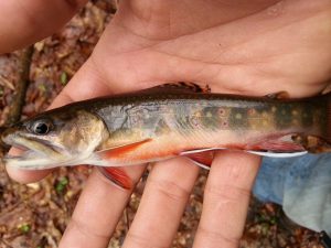
Potter County is fortunate to have the only Triple Divide east of the Mississippi River. The Allegheny River, Genesee River, and Chesapeake Bay watersheds all start in Potter County. Because of this Potter County has several miles of headwaters streams that are enjoyed by fishermen and other outdoor enthusiasts. Threats to these waters include oil and gas exploration, logging, and development. These things can all lead to sedimentation and other pollution events.
WATER QUALITY MONITORING.
The district, along with other watershed groups, has a network of in stream data loggers that are used to continuously monitor water quality throughout the county. These devices capture temperature, conductivity, and flow level readings at 15 minute intervals, 24 hours a day, 7 days a week. The data is used to establish a baseline for a particular stream under normal conditions. This data can be useful in the event of a pollution incident.
STREAMBANK STABILIZATION PROJECTS
Stabilization projects are performed to reduce the sediment load on streams where erosion has been accelerated by humans. Sediment is a major source of pollution and can clog the gills of fish, and reduce the overall water quality that we all use to drink, farm, swim, fish, and recreate. These projects have the added benefit of creating excellent fish habitat as a result. If you are a landowner with an erosion problem on your property please feel free to contact the district. We can provide technical assistance and seek funding through various grant programs.
USGS GROUNDWATER STUDY
USGS Groundwater Study Website
CANOE/KAYAK LAUNCHES
https://maps.pottercountypa.net/portal/apps/storymaps/stories/6c5a1ccac0c64e11984346a92604bef9